

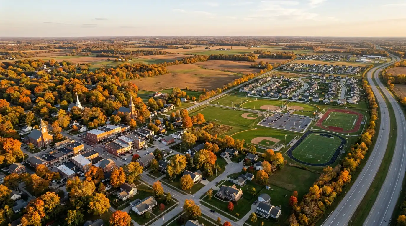
Zionsville is a town in Boone County; Westfield is a second class city in Hamilton County. Westfield’s city levy sits in one taxing district, 015, at a gross 2.3448 per $100 of assessed value for taxes payable 2026. Zionsville’s town levy spans seven Boone County districts, 1.3663 to 2.0336, and two of them carry Lebanon Community School Corporation.
Zionsville vs Westfield is a comparison across a county line, which decides more than the rate. Each town’s parcels sit in a different county’s taxing districts, under a different county levy, on a different county’s parcel record. MIBOR REALTOR Association reports each county and nothing below county level, so it has no Zionsville or Westfield sale price, and we do not derive one. What follows is structure from public records: the Census Bureau, Indiana’s Department of Local Government Finance and Department of Education, and the two municipalities’ own documents.
How do Zionsville and Westfield compare side by side?
Westfield has about twice Zionsville’s population on half its land, and one taxing district carrying its municipal levy. Zionsville has about a quarter of Westfield’s density, seven districts carrying its town levy and two school corporations inside its limits.
| Measure | Zionsville | Westfield |
|---|---|---|
| County | Boone | Hamilton |
| Legal form | Town, with a mayor | Second class city |
| Land area, 2026 Gazetteer | 67.16 sq mi | 33.68 sq mi |
| Population, July 1, 2025 estimate (Vintage 2025) | 33,624 | 66,258 |
| April 1, 2020 estimates base | 30,553 | 46,444 |
| Change since the estimates base | +10.1% | +42.7% |
| People per sq mi of land, January 1, 2025 boundaries | 501 | 2,010 |
| Taxing districts carrying the municipal levy | 7 | 1 |
| 2026 gross rate in those districts, per $100 | 1.3663 to 2.0336 | 2.3448 |
| School corporations levying in those districts | Zionsville Community; Lebanon Community | Westfield-Washington |
| Mean travel time to work, ACS 2020-2024 | 22.7 min (±1.2) | 25.1 min (±1.4) |
Sources: US Census Bureau, 2026 Gazetteer Files (boundaries as of January 1, 2026); Vintage 2025 subcounty population estimates (January 1, 2025 boundaries; the 2020 row is the estimates base, not a census count); American Community Survey 2020-2024 five-year estimates, Table DP03 (January 1, 2024 geography). Density is our arithmetic on the 2025 Gazetteer land inside the boundaries the estimate uses. Indiana Department of Local Government Finance, 2026 Certified Tax Rates by Taxing District and by District and Unit. Westfield: a Census Bureau special census counted 64,407 residents and 26,020 housing units as of September 15, 2025, a count on a different date, not a measure of growth or decline. Retrieved October 2, 2026.
One boundary has moved and one has not. Zionsville’s land is 67.16 square miles in both the 2025 and 2026 Gazetteers. Westfield’s rose from 32.97 square miles on January 1, 2025 boundaries to 33.68 on January 1, 2026 boundaries, the Census Bureau’s own record of annexation, and its Council approved further annexations on March 23 and August 24, 2026.
Which county is each town in, and why does it matter?
Zionsville is in Boone County and Westfield in Hamilton County, so every parcel-level check runs through a different county. Four things change with the county line.
- The record. A Zionsville parcel is confirmed with the Boone County Auditor or Assessor; a Westfield parcel with the Hamilton County Auditor or Assessor. The state’s rate files number taxing districts county by county, so Boone 006 and Hamilton 015 sit on two different lists.
- The county levy. Boone County levies 0.1930 per $100 of assessed value in every Zionsville district for taxes payable 2026; Hamilton County levies 0.2737 in Westfield’s district 015.
- The township layer. Westfield’s district 015 carries Hamilton County’s Washington Township at 0.0227. Zionsville’s territory is drawn from four Boone County townships, part of Eagle, all of Union, part of Perry and part of Worth, and six of its seven districts carry no township levy; district 031 carries Worth Township at 0.0032.
- The market figures. MIBOR’s Boone County figures sit behind any Zionsville conversation and its Hamilton County figures behind any Westfield one. Neither describes a town.
How do property tax rates compare between Zionsville and Westfield?
Westfield’s principal district, Hamilton 015, carries a certified gross rate of 2.3448 per $100 of assessed value for taxes payable 2026. Zionsville has no single principal district: its Zionsville Corporation district and two urban service districts (006, 029 and 034) are 2.0336, and its other four districts run from 1.3663 to 1.8531. The rate files do not show how many parcels sit in each Zionsville district, so none can be called the rate most owners pay.
| County and district | Taxes payable 2025 | Taxes payable 2026 | School corporation |
|---|---|---|---|
| Hamilton 015 Westfield | 2.3247 | 2.3448 | Westfield-Washington |
| Boone 006 Zionsville Corporation | 1.9795 | 2.0336 | Zionsville Community |
| Boone 029 Eagle/Zionsville Urban Service | 1.9795 | 2.0336 | Zionsville Community |
| Boone 034 Union/Zionsville Urban District | 1.9977 | 2.0336 | Zionsville Community |
| Boone 005 Eagle/Zionsville Rural District | 1.7871 | 1.8531 | Zionsville Community |
| Boone 016 Union/Zionsville Rural District | 1.8053 | 1.8531 | Zionsville Community |
| Boone 031 Worth/Zionsville Rural District | 1.4733 | 1.4220 | Lebanon Community |
| Boone 013 Perry Perry/Zionsville Rural District | 1.4205 | 1.3663 | Lebanon Community |
Source: Indiana Department of Local Government Finance, Certified Tax Rates by Taxing District, 2025 and 2026, and by Taxing District and Unit, 2026; district names are DLGF’s own. Gross rates before deductions, credits and the circuit breaker caps. This is general information, not tax or legal advice; confirm a parcel with the Boone or Hamilton County Auditor or Assessor and a licensed Indiana tax professional. Retrieved October 2, 2026.
On the principal rates the gap is 0.3112 per $100, 2.3448 against 2.0336. Against Zionsville’s lowest district, 013 at 1.3663, it is 0.9785, but 013 levies for a different school corporation and a lower town levy, so it is not the same structure at a different price. A change between 2025 and 2026 in either column says nothing by itself about an owner’s bill.
Westfield’s one district carries its own caveat. Hamilton County’s parcel layer (export of October 1, 2026) codes 208 parcel records inside the city to a district the Hamilton County Auditor labels “Westfield Ag Abatement (100% Corp. Abated)”, state district 025, at 1.6285, and 17 to 014, the unincorporated township district, at 1.9372. Neither carries the city levy, and parcel records are not homes. Most Westfield parcels are billed in district 015, but check the district on the parcel’s own record.
Where does the 0.3112 gap come from?
Mostly the municipal levy. Westfield’s city levy in district 015 is 0.7163, against Zionsville’s town levy of 0.4881 in 006, 029 and 034, a difference of 0.2282. Hamilton County’s levy is 0.0807 above Boone County’s, and Washington Township adds 0.0227; the school and library levies run slightly the other way.
| Levying unit | Zionsville 006, 029, 034 | Westfield 015 |
|---|---|---|
| School corporation | 1.3000 (Zionsville Community) | 1.2883 (Westfield-Washington) |
| Municipality | 0.4881 (Zionsville Civil Town) | 0.7163 (Westfield Civil City) |
| County | 0.1930 (Boone) | 0.2737 (Hamilton) |
| Library | 0.0525 (Hussey-Mayfield Memorial) | 0.0414 (Westfield Public) |
| Township | none | 0.0227 (Washington) |
| Solid waste district | 0.0000 | 0.0024 |
| Airport authority | none | 0.0000 |
| Total | 2.0336 | 2.3448 |
Source: Indiana Department of Local Government Finance, 2026 Certified Tax Rates by Taxing District and Unit, fund rows summed by unit. Differences are our arithmetic. Retrieved October 2, 2026.
Part of each school levy is voter-approved: referendum funds of 0.2444 and 0.0989 in the Zionsville Community Schools levy, 0.1700 and 0.0790 in the Westfield-Washington levy, and 0.0913 and 0.1374 in the Lebanon Community levy that applies in Zionsville’s districts 013 and 031. The circuit breaker statute, IC 6-1.1-20.6-7.5, caps property tax liability at 1 percent of gross assessed value for a homestead, 2 percent for other residential property, long-term care property and agricultural land, and 3 percent for other real and personal property; voter-approved referendum taxes are outside the cap (section 7.5(b)). For taxes first due in 2026 or later, IC 6-1.1-20.6-7.7 adds a supplemental homestead credit of the lesser of one-tenth of the homestead’s property tax liability or $300, not counting referendum taxes, applied by the county auditor without an application.
We do not turn these rates into a dollar bill, which also depends on assessed value, the homestead deductions Senate Enrolled Act 1 of 2025 is changing, local credits and the caps. Our Senate Bill 1 guide explains how the deductions are changing.
In Westfield the question is whether the parcel is inside the city and in district 015: Hamilton County’s 911 data holds 624 address points with a Westfield postal community outside any city, and city parcel records can be coded to districts without the city levy. In Zionsville the question is which of seven districts the parcel is in, because the district sets the rate, the school corporation and the town levy together, and on the Census Bureau’s 2020 ZIP code tabulation areas only about 60 percent of the town’s land lies in 46077. Read the certified district number on the county’s parcel record: Hamilton County for Westfield, Boone County for Zionsville.
Which school corporations serve Zionsville and Westfield?
Every taxing district holding Westfield city parcels (015, 025 and 014) levies for Westfield-Washington Schools and no other. Zionsville splits: five districts carry Zionsville Community Schools, and districts 013 and 031 carry Lebanon Community School Corporation.
| Corporation | IDOE number | Enrolment, 2025-26 | Grade span | Districts |
|---|---|---|---|---|
| Zionsville Community Schools | 0630 | 8,003 | Pre-K through Grade 12 | Boone 005, 006, 016, 029, 034 |
| Lebanon Community School Corporation | 0665 | 3,754 | Pre-K through Grade 12 | Boone 013, 031 |
| Westfield-Washington Schools | 3030 | 10,396 | Pre-K through Grade 12 | Hamilton 015, 025, 014 |
Sources: Indiana Department of Education, Corporation Enrollment by Grade Level, school year 2025-26 (grade span from its enrolment columns); Indiana Department of Local Government Finance, 2026 Certified Tax Rates by Taxing District and Unit. Retrieved October 2, 2026.
Westfield-Washington Schools’ own pages refer to “the residents of Washington Township” and describe its at-large board district as encompassing “the entire township.” Zionsville Community Schools describes a public school system for students “in Eagle and Union townships within Boone County, Indiana.” Lebanon Community School Corporation says it “encompasses South-Central Boone County,” and the Town’s adopted plan says the Lebanon district “covers the far west side of Zionsville, generally areas west of County Road 800 East.” We state boundary, grade span and enrolment only and make no judgment about any school. Confirm the corporation and the school assignment for a specific address with the county and the corporation.
How different is the housing stock in Zionsville and Westfield?
Zionsville’s stock is more heavily single-family detached and owner-occupied; Westfield’s is newer, with a median year built of 2010 against 1999. Both have about a tenth of their units in buildings of five or more.
| Measure | Zionsville | Westfield |
|---|---|---|
| Housing units | 12,066 | 22,030 |
| Single-family detached | 83.9% (±1.8) | 77.8% (±2.1) |
| Single-family attached | 4.5% | 6.6% |
| In buildings of 2 to 4 units | 1.5% | 4.1% |
| In buildings of 5 or more units | 9.8% (±2.4) | 10.1% (±2.3) |
| Median year built | 1999 | 2010 |
| Built 2020 or later, in the 2020-2024 survey | 4.8% (577 units) | 12.9% (2,848 units) |
| Owner-occupied share of occupied units | 84.2% (±2.3) | 79.5% (±2.6) |
| Median owner-estimated value | $587,800 (±$21,572) | $425,700 (±$17,028) |
Source: US Census Bureau, American Community Survey 2020-2024 five-year estimates, Tables B25001, B25024, B25034, B25035, B25003 and B25077, January 1, 2024 geography; shares are our arithmetic from the published counts, owner-occupied as a share of occupied units. Margins of error at the 90 percent level; those on shares are approximations by the Census Bureau’s formula for proportions. Retrieved October 2, 2026.
On the Census Bureau’s 90 percent test, the detached gap, the owner-occupied gap, the built-2020-or-later gap and the value gap all hold; the shares in buildings of five or more do not, so the survey does not separate the two on multifamily. About half of Westfield’s units, 49.8 percent, were built in 2010 or later, against 25.3 percent of Zionsville’s. Homes finished in 2025 and 2026 are not in the survey at all.
The value row needs its caveat. It is what owner-occupants said their homes would sell for, pooled over 2020 through 2024 in 2024 dollars: not a sale price, not a list price, not current and never a pricing input for a specific home.
What do the county sales figures add?
County context only. MIBOR’s August 2026 report puts the single-family median sales price at $455,000 in Boone County and $485,625 in Hamilton County. Neither figure describes Zionsville or Westfield, and neither can be converted into a town figure.
| Measure | Boone County | Hamilton County |
|---|---|---|
| Median sales price, August 2026 | $455,000 (+8.27%) | $485,625 (+5.98%) |
| Closed sales, August 2026 | 119 (-2.46%) | 536 (-3.60%) |
| Median sales price, January to August 2026 | $415,000 (-3.49%) | $490,000 (+3.81%) |
| Closed sales, January to August 2026 | 897 (+16.95%) | 3,995 (+4.28%) |
| Months supply, end of August 2026 | 1.9 | 1.7 |
Source: MIBOR REALTOR Association, Market Insights Report, August 2026, single-family residence only, Boone (page 14) and Hamilton (page 17) counties; footers read “updated 09/04/26.” Percent changes are MIBOR’s, against the same period of 2025. Retrieved October 2, 2026.
Boone County’s August median rests on 119 sales, a base that can swing in one month, and its January to August median is 3.49 percent below the same months of 2025. For the Boone County series in depth, see what the Boone County housing numbers actually say.
How much new housing is each town’s permit office authorizing?
Westfield’s permit office authorized 1,681 new housing units in 2025 and 1,386 from January to August 2026. Zionsville’s authorized 234 and then 181, all in one-unit buildings.
| Permit office | 2025 total | 2025, 1-unit | 2025, 5 or more units | January to August 2026 total |
|---|---|---|---|---|
| Zionsville | 234 | 234 | 0 | 181 |
| Westfield | 1,681 | 1,242 | 405 | 1,386 |
Source: US Census Bureau, Building Permits Survey, 2025 annual file and January to August 2026 year to date, all months reported. Counts cover each permit office’s jurisdiction, not legal town limits: the Census footnote says Westfield’s permit system also covers Westfield Washington Township. 1-unit includes attached single-family; Westfield’s 2025 total also includes 34 units in buildings of 2 to 4 units. Permits are authorizations, not homes built or sold. Retrieved October 2, 2026.
Of Westfield’s 1,386 units from January to August 2026, 820 were in one-unit buildings and 566 in buildings of five or more; all 181 of Zionsville’s were one-unit. If a new build is on your list in either town, our guide to buying new construction in Indiana covers the contract side.
How is each town governed, and where does its plan send growth?
Westfield is a city whose planning reaches the whole township around it; Zionsville is a town with two service districts inside its boundary.
Westfield
Westfield became a city in 2008 and a second class city by Ordinance 23-33, effective November 21, 2023. It has a mayor and a seven-member council, five elected by district and two at large, which becomes nine, six by district and three at large, on January 1, 2028. Its plan, Advancing Westfield: Looking to the Horizon, adopted March 23, 2026 by Resolution 26-115, describes its planning area as “a 56 square mile area along the western edge of Hamilton County that includes the incorporated city of Westfield as well as unincorporated sections of the township,” and says a 1977 township joinder “gave the city planning and zoning jurisdiction over the entire township.” So the City zones land it does not tax. Its housing objectives include “Plan for mixed-use trail-oriented development (TrOD) nodes along the Monon and Midland Trace Trails.” The City states the plan does not change zoning.
Zionsville
Zionsville is a town with a mayor and a seven-member Town Council, five elected by district and two at large, serving four-year terms. Its boundary comes from an Eagle and Union reorganization that took effect in 2010, an annexation of part of eastern Worth Township, and the Perry Township merger that took effect January 1, 2015, which also created the office of Mayor; the Town’s plan says the consolidations took it from “approximately 10 square miles to more than 67 square miles.” Its plan, Uniquely Zionsville: A Path to Our Future, adopted June 15, 2026 by Resolution No. 2026-02, aims to “Strategically manage the pace of residential development to align with fiscal goals and community infrastructure capacity” and to direct higher density residential development “to activity centers along key corridors.” It names two rural areas to preserve, and says the Town “intends to manage new housing development at a more measured pace.”
Westfield’s plan says where denser housing should go; Zionsville’s says it will pace housing and keep named areas rural. In either town, read the plan map for the parcel and its neighbors as guidance, not zoning.
Do services and utilities change inside each town?
In Zionsville, yes, by design. The adopted plan splits the town into an Urban Service District and a Rural Service District: urban properties receive Town services, while in the rural district Boone County maintains the roads and removes snow and the Town provides no trash service. Citizens Energy Group provides water to most of the Urban Service District and to the former Whitestown water territory west of County Road 800 East, which it bought in 2026; elsewhere homes rely on wells. Confirm the water provider for a specific address. The plan names four sewer utilities with separate territories, and most existing development north of County Road 300 South relies on septic systems.
In Westfield the variation is smaller but real. Citizens Energy Group’s Citizens Westfield division is the gas, water and wastewater utility for the Westfield area. Where sewer is not available, the City’s plan asks that customers be “informed of septic system maintenance requirements and potential signs of malfunction.” The plan names Duke Energy for electricity, but the Indiana Utility Regulatory Commission’s territory map places a small western part of the city in Boone County REMC territory. In both towns, confirm every provider for the specific parcel.
How do commutes and corridors compare?
On the American Community Survey’s 2020-2024 estimates, Zionsville’s mean travel time to work is 22.7 minutes, plus or minus 1.2, and Westfield’s 25.1, plus or minus 1.4; the difference holds at the 90 percent confidence level. It is the average one-way trip of each town’s workers 16 and over who did not work from home, to wherever they work, by any mode. It is not a drive time.
- Zionsville. The adopted plan names Interstate 65 and US 421 as the north-south corridors. INDOT’s current Statewide Transportation Improvement Program carries the 421 Forward project as Des. 2000076, with right-of-way and construction phases programmed in fiscal years 2026 and 2027; INDOT has published no construction start date. The Town describes the Big-4 Rail Trail as the 5-mile central spine of over 20 miles of paved pathways.
- Westfield. The City’s plan says U.S. 31 “roughly bisects the city and carries the highest traffic volumes, followed by State Road 32 (Main Street) and 146th Street.” State Road 32 through downtown is being rebuilt as 32 Connects, which the City lists for substantial completion in fall 2026. The City lists 7.92 miles of the Monon Trail in Westfield and 4.96 miles of the Midland Trace Trail.
If your work is in the Boone County corridor along I-65, see our guide to where to live if you work at LEAP.
Which one fits you, Zionsville or Westfield?
Neither fits everyone, and we do not rank them. It turns on density and housing age, how much parcel-level checking you will do, and how you want growth managed.
You want land and low density, about 500 people per square mile of land on the January 1, 2025 boundaries the population estimate uses, in a stock that is 83.9 percent single-family detached. You want an adopted plan that says it will manage the pace of residential development and preserve named rural areas. You are ready to check the taxing district, school corporation, service district and utilities on each parcel, because all four change inside the town. And on a rural parcel you accept county road maintenance, no Town trash service and often a private well and a septic system.
You want newer housing: a median year built of 2010, with 49.8 percent of units in the 2020-2024 survey built in 2010 or later. You want one taxing district carrying the municipal levy and one school corporation across the city, and you will still confirm the district on the parcel’s own record. You want a plan that says in writing where denser housing goes. And you are comfortable in a city still annexing land, whose permit office, which also covers Westfield Washington Township, authorized more than 1,000 units in 2025 and again from January to August 2026.
If the lowest gross rate is what you are after, Zionsville’s districts 013 and 031, at 1.3663 and 1.4220, are the lowest in either town, but they carry Lebanon Community School Corporation and the lower town levy of 0.3076 that goes with the districts DLGF names Rural. If one district and one school corporation matter more than the rate, Westfield’s 015 at 2.3448 is the simpler structure. For the same comparison against Carmel, see Carmel vs Zionsville.
What should you confirm before you write an offer in either town?
Here is the readiness test. For the exact parcel, confirmed against the county’s record rather than a listing, you should be able to state:
- The county: Boone for Zionsville, Hamilton for Westfield.
- That the parcel lies inside the Town of Zionsville or the City of Westfield, not merely at a Zionsville or Westfield mailing address, and in Westfield whether any pending annexation ordinance names it.
- Its certified taxing district number and that district’s 2026 gross rate: in Zionsville 2.0336, 1.8531, 1.4220 or 1.3663; in Westfield 2.3448 in district 015, or 1.6285 or 1.9372 if the record shows district 025 or 014.
- Its school corporation, Zionsville Community, Lebanon Community or Westfield-Washington, and the school assignment, confirmed with the corporation.
- Its water source, its sewer provider or septic system and its electric utility, and in Zionsville whether it is in the Urban or the Rural Service District.
- What the adopted plan’s map shows on and around it.
If you cannot state all six, you are not yet comparing Zionsville and Westfield. You are comparing two mailing addresses in two counties. For the filing and closing steps once you can, see moving to the Indianapolis north side.
Frequently Asked Questions
Is Zionsville or Westfield in Hamilton County?
Westfield is. Westfield is a second class city in Hamilton County, and Zionsville is a town in Boone County. The county decides which auditor and assessor hold the parcel record, which county levy is inside the tax rate, and which MIBOR county figures apply: Hamilton County for Westfield, Boone County for Zionsville.
Which has the lower property tax rate, Zionsville or Westfield?
On the principal rates for taxes payable 2026, Zionsville: 2.0336 per $100 of assessed value in its Zionsville Corporation district and two urban service districts (Boone 006, 029 and 034), against 2.3448 in Westfield’s district 015, Hamilton County. Zionsville’s other districts run from 1.3663 to 1.8531, and its two lowest carry Lebanon Community School Corporation. These are gross rates before deductions, credits and the circuit breaker caps, not bills.
Why does Zionsville have seven tax districts and Westfield one?
Seven Boone County taxing districts carry the Zionsville Civil Town levy, at two town levy rates (0.4881 and 0.3076) and with two school corporations. In Hamilton County only district 015 carries the Westfield Civil City levy. Hamilton County’s parcel layer still codes some parcel records inside Westfield to districts without the city levy, so check the district on the parcel’s own record in either town.
Which school corporation serves Zionsville and Westfield?
Every taxing district holding Westfield city parcels levies for Westfield-Washington Schools (IDOE 3030, 10,396 students in 2025-26). In Zionsville it depends on the district: five carry Zionsville Community Schools (IDOE 0630, 8,003 students) and districts 013 and 031 carry Lebanon Community School Corporation (IDOE 0665, 3,754 students). All three run Pre-K through Grade 12. Confirm assignment for a specific address with the county and the corporation.
Which is bigger, Zionsville or Westfield?
Zionsville has more land and Westfield more people. The Census Bureau’s 2026 Gazetteer gives Zionsville 67.16 square miles of land and Westfield 33.68. The Census Bureau’s estimate for July 1, 2025 (Vintage 2025) is 66,258 for Westfield and 33,624 for Zionsville, about 2,010 and about 500 people per square mile of land on the January 1, 2025 boundaries the estimate uses.
Is Westfield or Zionsville growing faster?
Westfield, on both public measures. Its population estimate rose 42.7 percent from the April 1, 2020 estimates base to July 1, 2025, against 10.1 percent for Zionsville. Westfield’s permit office authorized 1,681 new housing units in 2025 and Zionsville’s 234; the Census notes that Westfield’s permit system also covers Westfield Washington Township. Permits are authorizations, not homes built.
Is the commute shorter from Zionsville or Westfield?
On the American Community Survey’s 2020-2024 estimates, Zionsville’s mean travel time to work is 22.7 minutes, plus or minus 1.2, and Westfield’s 25.1, plus or minus 1.4, a difference that holds at the 90 percent confidence level. The measure covers workers 16 and over who did not work from home, to every destination by every mode. It is not a drive time to anywhere.
What is the median home price in Zionsville and Westfield?
MIBOR REALTOR Association publishes nothing below county level, so it has no median for either town. For August 2026, single-family residence only, the median sales price was $455,000 in Boone County and $485,625 in Hamilton County. The Census Bureau’s 2020-2024 median owner-estimated values, $587,800 in Zionsville and $425,700 in Westfield, are owners’ own estimates, not sale prices and not current.
Is Zionsville a city like Westfield?
No. Westfield is a second class city, effective November 21, 2023. Zionsville is a town: Indiana Code 36-4-1-1 classes every municipality that is not a city as a town, and the state lists its levying unit as Zionsville Civil Town. It has a mayor because its reorganization with Perry Township, effective January 1, 2015, created the office.
Keep reading
- Zionsville, Indiana
- Westfield, Indiana
- Zionsville, Indiana real estate: one town, seven tax districts
- Living in Westfield, Indiana: tax rate, growth and where the city ends
- How the north side towns compare
- Carmel vs Zionsville: which one fits you?
- Indiana Senate Bill 1: what the property tax changes actually do to your bill
- Carmel vs Westfield, Indiana: how the two cities actually differ
Compare the two on the parcels you are considering
We work across Hamilton and Boone counties. Send us the Zionsville and Westfield addresses you are weighing, and before you write an offer we will read each county record with you for the municipality, taxing district, school corporation and utilities, and prepare a comparable sales analysis for each home.